Maple Pass Loop trail - July 2024
North Cascades Maple Pass Loop hike - July 16, 2024
Well, sort of, actually the Maple Pass Loop trail was actually on US Forest Service land instead of in the National Park Service. As mentioned, this requires the Annual Interagency National Park Pass (or other pass that the NPS sells) or a $5 fee.
From our campground, it was about a 25 minute drive to the trailhead. We had no trouble getting a parking spot. I have seen others who note having to park 1 mile down the road and walk to the trailhead (starting the hike at 1:30pm). Seen from the trail and when leaving, there were a few cars on the road, but no one having to park that far away. I brought a lanyard to hang our pass on the rearview mirror, but with this car, you could not see it well. So, I moved it to the dashboard. Still in the lanyard, it almost melted into the dashboard. The NPS website for North Cascade, in the warning section, warned of car break in at parking along Hwy 20, saying to take all valuables and even all the cords for your electronics. We heeded the warning, so did not crack the windows to keep it cooler.
We grabbed everything for the hike, and the mosquitos were already out and about even in the parking lot. No restroom in this parking lot, so the restroom break back at the campsite had to last. I coated on bug spray and sunscreen, which since returning home, I saw an article that you are not supposed to put them both on at the same time. I believe that it recommended sunscreen and then 15 minutes later add bug spray. We both took our hiking poles.
We started about 7:30 am and finished about 12:30 pm. It was about 7 miles and 2000 ft elevation gain -- I saw different distances, and we did the Lake Ann turn off trail at 1 mile each way. It was recommended as easy, short, flat, and worth it, but I do not recommend it. There were a ton of mosquitos on the trail, making the side trip to Lake Ann as one of the two worst places for them. Also, the views of the lake from above were much better. The side trail may be better in the winter, but the view was very blocked by plants growing right next to the lake when we went. On the trail, I put on the bug head net and kept on until close to the bottom/start.
We hiked the main trail counter-clockwise, which was recommended on the internet. Though I was shocked/disappointed that there was a lot of uphill after what I thought was Maple Pass, thinking it was all downhill after the Pass. Maple Pass was the second heavily mosquito area; we stopped for a snack there. Travis said that we had to climb out of the Pass. Downhill was steep, so would have been steep uphill, if hiked the opposite direction, so I think still a good recommendation. Also, the views were supposed to be better going down if hiked counter-clockwise. It was pretty. Okay, some pictures.
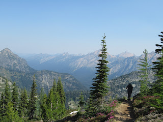
Columbine flowers and Lake Ann from above. There was also some snow that looked like it fell from higher up the mountain by Lake Ann's banks. Then some amazing views. It was a very pretty trail.
Next Up...Last day in North Cascades and Seattle


Comments
Post a Comment